Map Group survey team has over 10-years of great experience in Topographic design survey. The data collection methods are driven by the purpose for which the survey will be used and the accuracy required. We understand time, accuracy and compliance fuel the profitability of our customers.
Topographic offers a comprehensive suite of services designed around your surveying needs.
Map Group Ltd.,
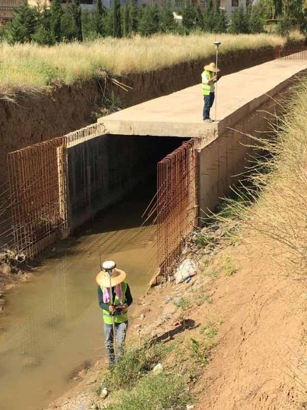
uses GPS (Global Positioning Systems) or GNSS (Global Navigational Surveying Systems) Surveying is the most advanced positioning and data recording technology available for making Topographic survey.
Using available Satellites from the US, Russia, Europe and China, The Receivers record satellite signals and with internal receiver software, sub-centimeter accurate horizontal and vertical positioning data can be provided about any point or feature,
In addition to GPS we are using other professional Instruments like total station, Theodolite, Digital level and Automatic level for getting high accurate results.
Map Group Ltd., has conducted numerous electromagnetic conductivity (EM) surveys, metal detector and multi-frequency surveys to locate metallic buried utilities and electrical cables.
Map Group Ltd. has pioneered the 2D and 3D aerial mapping system in the Kurdistan Region of Iraq by introducing a powerful yet intuitive autonomous mapping service with eBee RTK Drone, a latest technology in the market that takes the aerial surveying to a prime level. Weeks of manual hard work with limited accuracy are now waived by just a couple of hours of drone work, in addition to completely avoiding Health and Safety risks associated with surveying deserted land.
Map Group Ltd., creates framework for successful cadastral conversion projects in using 10-years of project management, digitizing and coordinate geometry (COGO) mapping experience. We create cadastral databases using a combination of precision automation techniques, including entry of distances and bearings from recorded plats, scanning and digitizing tax assessment maps. The scanned and digitized cadastral is then adjusted to “best-fit” survey control and plan metric features (centreline, edge of pavement, and buildings). A network of geodetic control points is positioned throughout the project to ensure the continuity for future database inclusion.